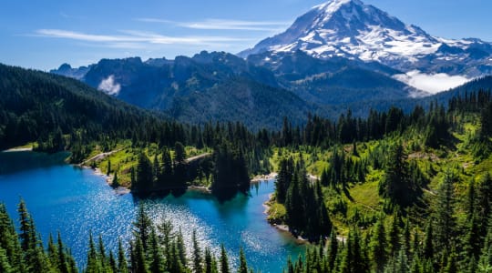
Mount Rainier is an active stratovolcano located in the Cascade Range of Washington State, in the United States. It is the highest mountain in the state and the most heavily glaciated peak in the contiguous United States. The mountain is located about 87 miles (140 km) southeast of Seattle, and it can be seen from the city on clear days.
Mount Rainier has an elevation of 14,411 feet (4,392 meters) above sea level, making it the fifth-highest mountain in the contiguous United States. It is a popular destination for mountaineers and hikers, with several trails leading to the summit, the most popular being the Disappointment Cleaver route.
The mountain is surrounded by Mount Rainier National Park, which covers an area of 369 square miles (956 square kilometers). The park offers a variety of recreational activities, including hiking, camping, and wildlife viewing. The mountain is also home to several glaciers, the largest of which is the Emmons Glacier, which is over 4 miles (6.4 km) long.
Mount Rainier is considered to be one of the most dangerous volcanoes in the world due to its active status and the large population centers that surround it. The last significant eruption occurred over 1,000 years ago, but it is still closely monitored by the United States Geological Survey for signs of activity.