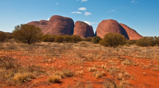
Kata Tjuta, also known as the Olgas, is a group of large, domed rock formations located in Australia's Northern Territory. It is situated about 25 kilometers (15.5 miles) to the west of Uluru (Ayers Rock) and is considered one of the most important natural landmarks in the region.
Kata Tjuta consists of 36 massive, red rock domes that rise up to 546 meters (1,791 feet) above the surrounding plain. The highest peak, Mount Olga, is 1,066 meters (3,497 feet) above sea level, making it 198 meters (650 feet) higher than Uluru.
The rocks that make up Kata Tjuta are believed to have been formed about 500 million years ago, through the process of erosion and weathering. The name "Kata Tjuta" means "many heads" in the language of the local Aboriginal Anangu people, and the site has great cultural and spiritual significance for them.
Kata Tjuta is a popular tourist attraction and visitors can explore the site on walking trails. The Valley of the Winds walk is a popular trail that takes visitors through some of the domes and offers stunning views of the surrounding landscape. The site is also popular for its sunsets and sunrises, which create a stunning backdrop against the red rocks.